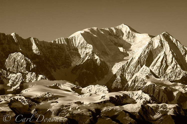
Corrected: Mount Bona, University Range.
This image was taken one evening after returning from a long flight toward the southern area of the park. I’d been down in the St. Elias Mountains Range, on my first trip to see Mt. St. Elias. Fantastic mountain!
I shot images of various mountains in the area, including Mount St. Elias, Mount Logan, Mount Lucania (both across the border, in Canada), Kings Peak, and countless others I have no idea what their names might be. Or even that that officially have names. The majority of the peaks in the park are not named.
An interesting discussion, to me, is the decision of what parameters to set myself, or any photographer doing a similar project, for working within. I’fm standing outside the park boundary, and shooting a scene inside the park, that reasonably should be included. How about if I’m inside the park, and I point my camera toward something outside the park, or to an animal as it leaves the park? What rules do we follow when we work on a project such as this? They’re completely arbitrary, of course, and those can often be the most difficult to adhere to. To what end should the rule or parameter serve?
For a personal project such as this, I gave myself a very loose and fluid instruction; if it feels right, go with it, and if it doesn’t, avoid it. I have some images I won’t use as part of this project, even they might be nice photos, but they don’t feel like they belong in this project, they don’t add to the general tone of what I’m working on.
So for this image, I thought it belongs with the collection. I’d been out with Don, a superb pilot, all afternoon, and we flew back by the University Range. I’ve visited this mountain range many times, but always from the northern side. This was the first time I’d really had a view of the southern side of the University Range. Mount Bona (the higher of the peaks), here, and University Peak (just below and to the right) really caught my eye.
Stupidly, I forgot to make decent notes of this flight, and when I was editing these images for this project, several years later, was confused on which mountains these were. Props to Damien Gildea (a fellow Aussie) for noticing and correcting my earlier mistake.
The stark abruptness of the precipitous exposed rocks faces give it a real mountainous feel, and the warm evening light playing on the peak and the snow just top capture what I think of when I think of the St. Elias Mountains.
An aerial photo of Mt. Bona and University Peak, University Range, St. Elias Mountains, Wrangell-St. Elias National Park and Preserve, Alaska.

This is a beautiful shot, Carl. But it is the south face of Mount Bona. The pyramidal peak in the right foreground is University Peak. It looks like you are flying above the Hawkins Glacier, east of McCarthy.
Hey Damien,
Thanks for the correction. I should write things up sooner, so I don’t get so ridiculously confused about which mountain is which with these photos. Thanks again.
Cheers
Carl